Showing posts with label Batangas. Show all posts

Saturday, January 12, 2013

What do Maculot, Romelo and Manabu have in common? - Part 1

I climbed Mt. Maculot every week last December to lose some inches on my tummy. And because not everyone likes to climb the same mountain over and over again, and because I'm really a loner, I climbed those four times alone.

the blogger at Mt. Maculot's Rockies

The Rockies campsite is safe to climb alone. (I can almost hear my few more experienced mountaineering friends disagreeing with me.) The trail is wide and there are no forks aside from one early in the trail, but there’s an arrow pointing to the right direction so I really don't see how anyone could get lost.

My first two weeks were bliss. I was literally alone at the campsite aside from a big tuko on the first and a monkey on the second week. I was able to pray (which I do secretly when there are mountaineers around) for the safe climb, lie down on the tables, close my eyes and savor the quiet sounds of wind on the trees and the idea of being alone 300+ meters above sea level.

Friday, October 21, 2011

Mt. Manabu v2 (Solo Climb)

It is one of those days when you're itching to go out and you don't have anyone to go out with because they're either in school or just plain busy. In my case, my climb buddy wasn't available that day when I was so in the mood for a dayhike.

It was a Friday, August 19th, and life had been so good that I wanted to shed that extra energy I had in me the whole week; more so, I wanted to celebrate by doing something that I love best.

Because the previous night proved futile in looking for someone to climb with, I woke up quite late the following morning. It was already around 9:30 AM when I logged in to Facebook and hoped to find a hiking buddy among my online friends... to no avail.

But then I have done solo trips before. My first climbing experience was only with a guide up Mt. Romelo. So after feeding Princess, I packed my small backpack and got ready to leave. It's really a good thing when you already know what to bring. It makes packing very easy.

I was in Alabang by 10:30 AM. I had Manabu Peak in mind. I had been there before and it's the safest mountain I could think of to climb alone without a guide. Also, I wanted to go visit Mang Pirying who I failed to see the first time I went there.

It was a two-hour ride from Alabang to Fiesta Mall in Lipa. It's my first time to go that route and I must tell you it's easier to use than riding a Lucena-bound bus like my first time. Tricycles near Fiesta Mall will take you to the jump-off for P100.00.

It was already 1 PM. There was no trace of mountaineers at the jump-off. I went up to the store to buy something to bring Mang Pirying. It was a good thing I mentioned his name to the store owner cuz I was advised he was not in his home in the mountains that day. According to the store owner, Mang Pirying was fetched by some mountaineers early that morning. They'd have his eyes checked in a nearby hospital.

Such luck. It was my second time to go up Manabu Peak and I still wouldn't be seeing Mang Pirying in the flesh.

I was also informed that no one climbed Manabu Peak that day nor the night before that. I had the mountain all to myself! I was ecstatic. But it was past 1 PM and I knew it gets dark earlier in the woods. After changing into climbing clothes, I immediately set off. It was 1:47 PM.

The stillness of the forest started becoming eerie halfway through the trek. I remedied that by pumping up the volume of my earphones, but leaving one ear clear so I could still be aware of what's going on around me.

image

I stopped at the fork for a while and looked at the two trails, both going up the peak, one passing by Mang Pirying's hut, the other passing by the grotto. When I first climbed Manabu Peak, I used the Mang Pirying trail in climbing up then the grotto trail in going down. I told myself that just for a change, I would use the grotto trail this time, then pass by Mang Pirying's hut when going down.

image

Unlike the first time I passed by the grotto, it was clean this time. No more liquor bottles. No more plastic bags scattered around.

My stomach started making funny noises when I sat down for a while. I realized I haven't had lunch. The only food I had with me was a can of San Marino Tuna Paella. I wanted to take it out and eat but the summit was still far. I was so pressed with time that I disregarded my stomach and carried on with the trek.

It rained a little harder than a drizzle when I reached the grassland. It was the loneliest part of my climb. Moreso when I entered the trail between the grassland and the peak. It was the most masukal part of the climb and I was drenched in a mixture of sweat and rain.

I love going out alone at times but I've always had things pre-planned. This was the first time I climbed a mountain alone without even a guide and I was so pressed with time. I really had to get back to the jump off before it gets dark. I had my headlamp with me but even two headlamps wouldn't do for me considering I'd be alone in the middle of the mountains in the dark.

The cloudy skies were not helping. It was making the surroundings darker than what that afternoon could have normally been if there was no rain.

image

After what seemed like an endless walking, I finally saw a glimpse of the top of the white cross through the leaves. It was such a relief. The white cross was like a light at the end of the tunnel, or in my case, the goal after walking alone in the forest for the longest two hours of my life.

image

I took pictures at the summit, of course, using my cheap CDR King tripod. I went down to the campsite and brought out my tuna paella. I alternately ate and took jump shots. LoL! After finishing the can, I immediately headed down using the trek that would pass by Mang Pirying.

image

I was kinda hoping the old man would already be there. But the hut was so quiet when I reached it.

image

Reaching the fork made breathing a little easier. It had stopped drizzling that time, but the sounds of the forest was telling me it would soon get dark.

I was back at the jump off at exactly 5:27 PM. Exactly three hours and forty minutes after I left. It might have been so lonely being alone up there, but I found myself humming a little while I took a bath. I made it. My mountaineering friends might not be happy with my solo climb even if it was just Manabu Peak, but it was somehow a milestone for me.

Thursday, September 1, 2011

Mt. Maculot's Garbage Problems

Mt. Maculot's campsite, as I mentioned in my recent post titled Mt. Maculot: A Not-So-Pleasant-Surprise, has a big problem on waste management. It wouldn't have reached that point if all of us "mountaineers" are disciplined enough to "Leave No Trace" and if we really care about the environment.

image

Judging by the pile of liquor bottles, I think that some (if not most) of the hikers go up Mt. Maculot just to drink and party. Have the mountains become the new venue of Friday/Saturday/long weekend night-outs?

Perhaps some would argue, "What are the registration fees for?"

Do you think P10.00 is enough to let the locals chase our garbage in the mountains? To leave behind our water bottles and butanes so our backpacks wouldn't be as bulky when we go down?

These mountains were in peace before men learned the sport/hobby of climbing. These mountains didn't invite us to go up and spend our nights in its wilderness for a thrill. But we climb these mountains, nonetheless – as environmentalists, as thrill-seekers, as tourists. For what we don't know, these mountains perhaps consider us as unwanted visitors.

But whatever purpose we have for climbing, let's just do the mountains a favor. Please do not leave anything, especially your trash, behind.

I took a couple of videos just to show how not-so-pleasant Mt. Maculot's Rockies campsite has become.

Take a look:

Monday, August 29, 2011

Mt. Maculot: A Not-So-Pleasant Surprise

Last week of July, I learned that my young friends in MLQU Stallions Outdoor Club (MSOC) were planning to do a Mt. Maculot hike on the first weekend of August. I get invited to MSOC climbs most of the time so it was kinda automatic (especially with these young members) that I would be joining them on this one.

No one among those climbing that time had been to Mt. Maculot before, while I already did a traverse of the mountain September last year with my friend Danilo. So I was immediately appointed as the guide.

It was my first time to ever guide a group of climbers in the mountains, but as they say, there's always a first time for everything. My knowledge of the route, though, was Brgy. Pinagkaisahan – Grotto – Summit – Rockies – Brgy. Tiko. They were planning on a night trek to Rockies but I remember the trail as very easy so I agreed.

K (who is a member of MSOC himself) and I met the other members of the team around 9 PM at the Buendia bus terminal. We took a Lipa-bound bus cuz a road restoration was going on in Cuenca and no bus would go directly to the town.

The kids lingered for a while at McDonalds Lipa so we got to Cuenca a little past midnight. I had to ask someone from a Karinderia on how to get to the registration area cuz there were no tricycle that time of the night.

139_0072

It drizzled on and off since we got to Lipa up to the time we got to the Rockies campsite. The trail was easy enough especially that we walked in a very easy pace. The kids wanted to enjoy it. It was, after all, their first climb since they graduated from the MSOC training.

I was surprised to see the camp site so different from what I saw last year. The lone small hut last year was now three big huts, and the small pile of garbage multiplied a hundred times. And that's not exaggerating because in one hut alone, we found two sacks full of garbage, not to mention those that were strewn around and plastic bags left hanging on roof of the huts. One simple word to describe the campsite of Mt. Maculot these days: kadiri.

I just wish all of us who love to admire the beauty of nature are all sensitive enough not to do the things that we know would harm what we enjoy seeing.

And then again that differentiates someone who loves to climb mountains, from someone who loves the mountains and nature in itself; a mountaineer from an environmentalist.

“This is not to suggest, however, that the mountain areas are free of environmental problems, notably deforestation. The more pragmatic view is that while there are inevitably conflicts between man’s activities in the mountains and the natural ecological balance, it is the extent of the resulting problems that has been overstated.” - Tourism Development and Environmental Management in Nepal

Back to the climb, the weather had not been so friendly even after sunrise. K and I attempted to climb the Rockies while the others were still resting but K wouldn't even attempt to go up with the thick fog and howling winds.

A few hours after, though, the fog had lessened and the wind became bearable. We attempted to go up the Rockies even if we couldn't even see a trace of the Taal Volcano through the fog. But then I thought it's better than to not bring them to the Rockies at all.

139_0112 139_0170 060820111457

It was a great climb with the kids. I was also kinda pleased that they were careful not to leave any of our garbage behind. After all, that's what MSOC had taught them to do – to "Leave No Trace."

060820111468

Wednesday, February 23, 2011

MakTrav with MSOC

The last mountain that I climbed was Mt. Pundaquit when I went with the MSOC to Anawangin Cove. It was November last year.

My friend K also invited me to their Batulao climb last January 9 (Sunday) but he texted me January 8th while I was already in Calapan. I couldn't actually go home Saturday night from an out-of-town trip and leave again the following morning for a mountain climb. Yea, pwede, but my Nanay would fume mad and Princess would feel depressed two days in a row and that's bad.

Then some of the MSOC applicants invited me for a MakTrav the following Sunday, January 16th, and I immediately said yes. It would be my first major climb ever.

K didn't join the team so I went to the Jam Transit station in Buendia alone at 3 AM. It was even baha in Pasay Rotonda because Manila Water was working in the area. Most of the team members were already there when I arrived.

We left for Sto. Tomas at 4 AM via an air-conditioned Jam Transit. The trip cost P90.00 because we were all charged student fare. Majority of us were students, anyway.

It was a pleasant team. I already met Sir Maldz and three of the applicants during the Pundaquit-Anawangin trip so I didn't feel like an outcast anymore. Not that they made me feel like an outcast the first time, it's just that it's easier to travel with people you already know.

The kids (as I call the applicants) ate their packed breakfast even before the bus left the station. I didn't eat. It's hard for me to eat that early in the morning. I slept through the trip instead.

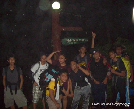
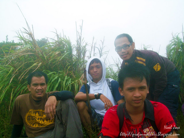
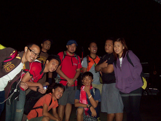
 the Maktrav team before leaving Sto. Tomas town (clockwise from left) me, Prince, Sir Maldz, Sir Jury, Sir Aim, Troy, Khollin, Rain, and Akil

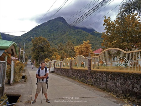
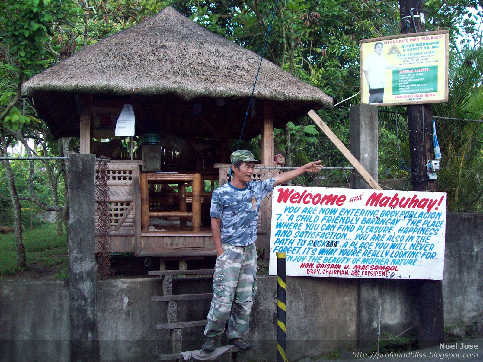
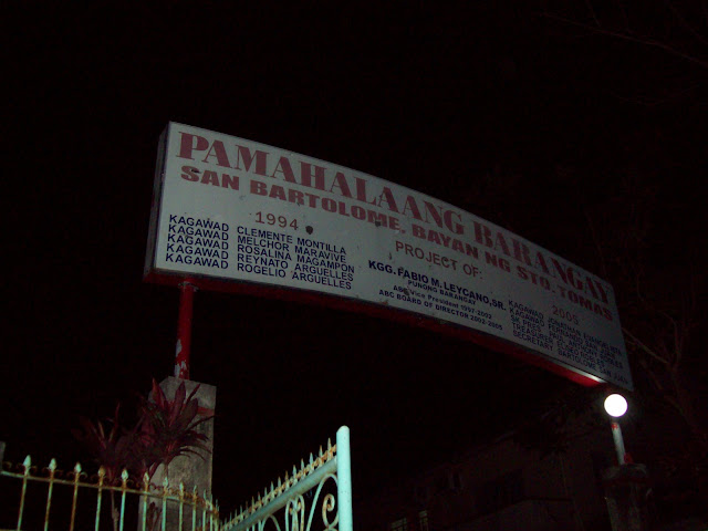
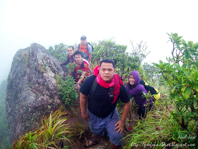
We were at Sto. Tomas after an hour and hired a tricycle to take us to the jump-off in San Bartolome. The air was so cold that morning you could hear the wind howling and the trees were swaying like mad.

After praying (which was led by Troy), we left the registration area at exactly 6 AM. It was still dark but not much that we would need headlamps. But OC as I am, I wore the headlamp around my neck just in case.

With an elevation of 1,090+ MASL and a difficulty of 6 out of 9, MakTrav is classified as a major climb. And before this, the hardest mountain I climbed was only Pico de Loro with the the bird's beak going almost 90 degrees.

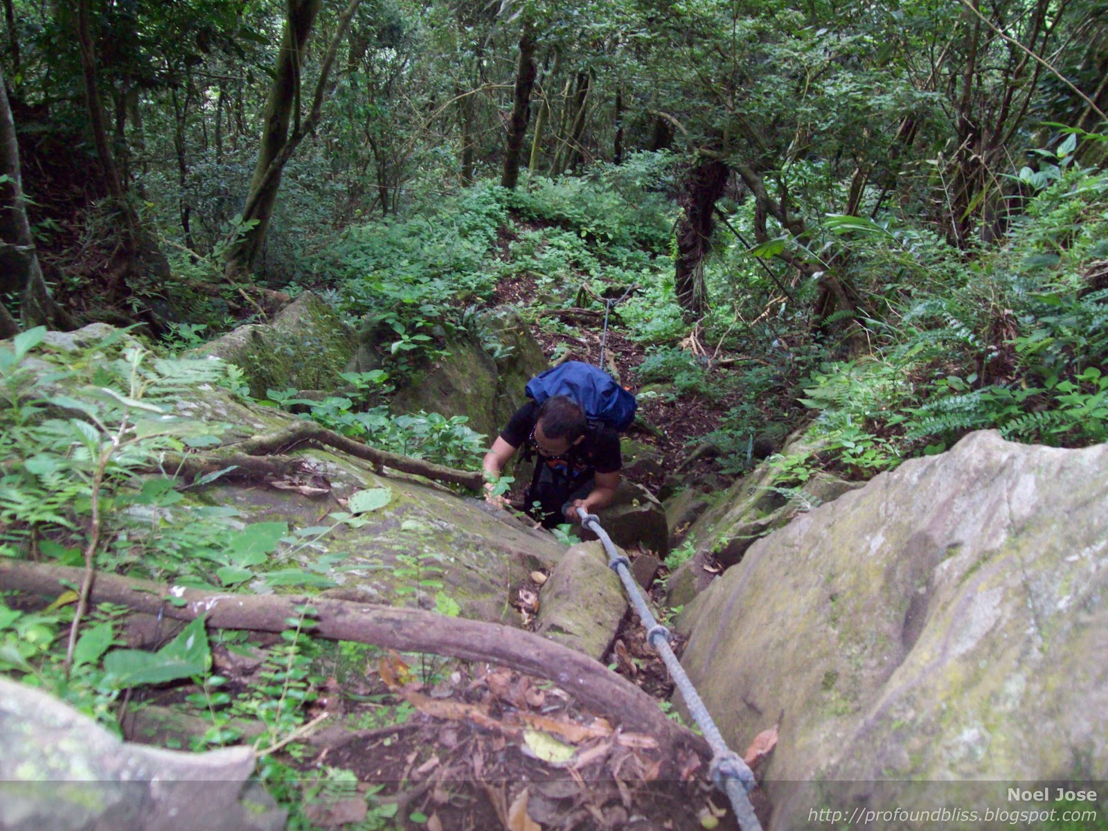
Good thing I expected the worst because the trail, though moderately steep at first, became difficult midway up. The wind became stronger and it made the passage across the cogon area very difficult. The sharp blades of the tall grass were slapping at our skin.

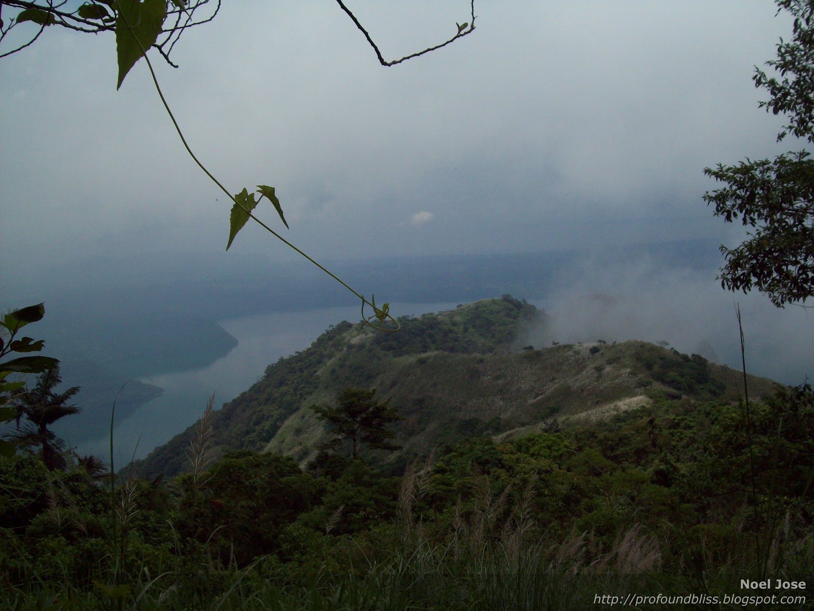
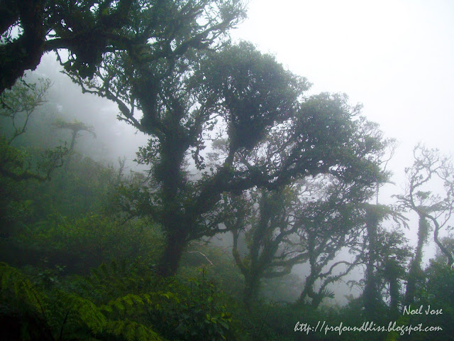
We arrived at the Melkas campsite at about 10:30 am and decided to have an early lunch. It started to become so cold with the wind bringing in the fog. It was there where I first set eyes on limatiks. These blood-sucking creatures are mean. You won't really feel they're sucking on your skin unless you see them. Too bad none of us were able to take pictures of the limatiks. But here's a vid of the Melkas campsite.

Passing through the Melkas Ridge was a little nerve-wracking. Prince, one of the applicants who says he's afraid of heights, almost crawled at the ridge.

 Troy, Khollin, Prince, me, and Sir Aim

We arrived at Peak 1 at exactly 11:54 AM. Sir Maldz, being the leader, arrived a few minutes ahead of us, while Rain, Prince, Khollin, and I were the next to arrive. Troy and Akil were at the tail with Sir Jury and Sir Aim (who called his girlfriend that's why they stopped).

 Sir Maldz, Rain, me, and Prince at Peak 1

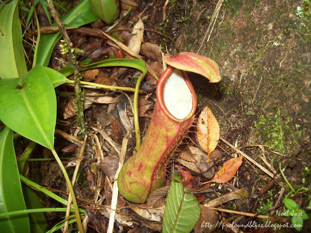
Aside from limatiks, trapper plants can also be found in Mt. Makiling.

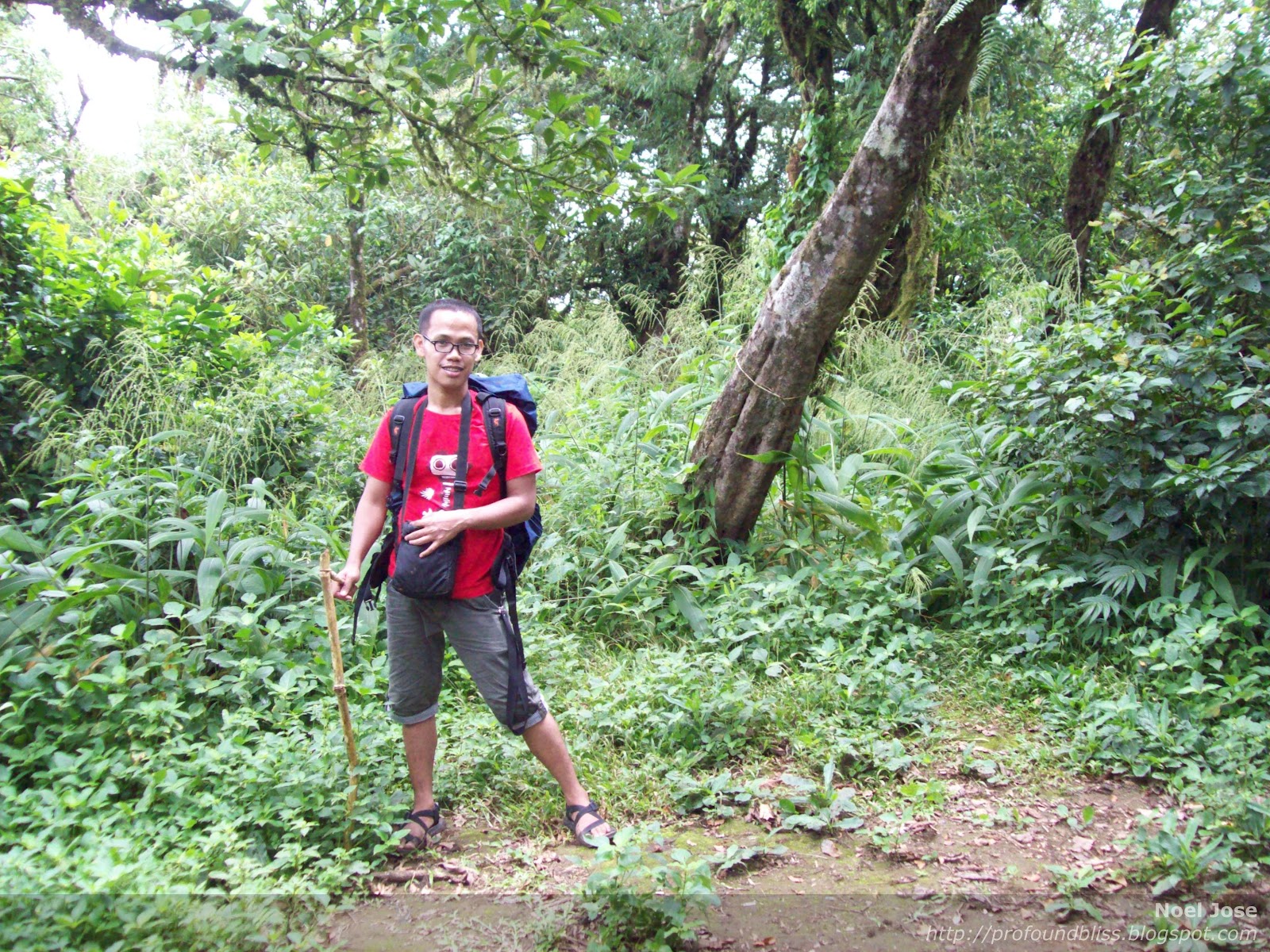
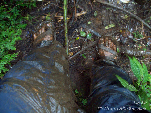
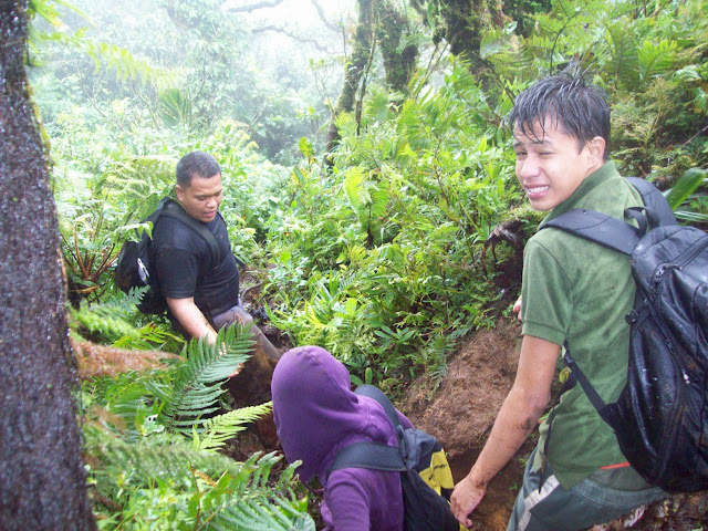
After Peak 1, the trail becomes more complicated. We found ourselves either clinging on vines and ropes or sliding on mud. The mud was very evident on my feet and on the Lagalag trekking pants that I have only used for the second time (the first being Calapan).

The temperature became lower as we headed for the summit. And since the kids didn't know it was that cold in Mt. Makiling, they didn't bring jackets aside from Khollin. I have to tell you, though, that my thick Bench fleece wasn't enough for the cold. I should've brought with me a windbreaker.

And since the kids had no jackets, one of them, Akil, frightened us all when he started getting chills.

 Akil in green shirt before the chills; all wet in the rain.

Troy volunteered to carry Akil's bag and Rain became his official alalay. We really feared hypothermia might have hit him but it was too late to go back. We were just a few minutes away from the summit and the trail going back was very complicated.

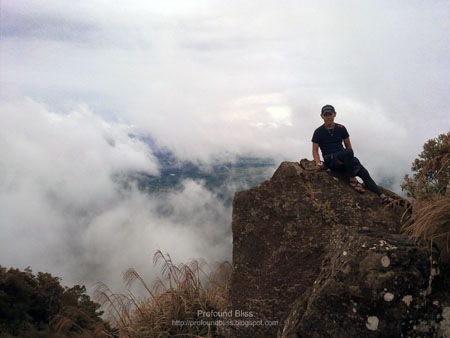
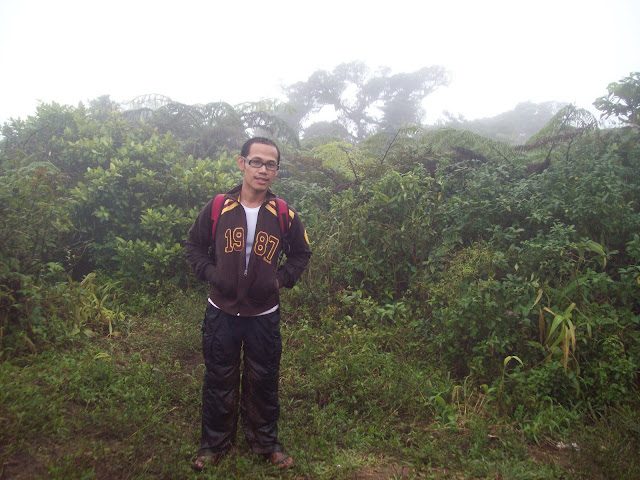
 Me at Mt. Makiling's summit

When we reached the summit, they made Akil sit in the bushes to hide him from the wind. Sir Aim also gave him his jacket and threw whatever they could throw on Akil just to keep him warm. Good thing Sir Aim had a stove that he was able to heat water for Akil.

 That's Akil covered up in layers of clothing to keep him warm. Sir Aim behind him desperately trying to heat water, protecting his fire from the strong wind.

When Akil felt a little better, we immediately took off for the trail going to Los Baños, disregarding Peak 3. But it was still a long trek going down. It was 2:45 when we left the summit. Sir Maldz and Sir Jury led the team while Sir Aim stayed at the tail. The two sirs walked so fast, followed by Rain, Akil, and me. Good thing the trail had no ligaw because I suddenly found myself alone in the middle of the trek. Rain and Akil walked so fast that I was left behind, while the others in the tail group were much slower than I was that they were so far behind me!

Then I remembered Sir Jury's kwento before we set off that morning. He related how one time, he and another MSOC member couldn't find their way out while descending Mt. Makiling. They would keep on walking but would find themselves in the same place over and over again. It was almost dark that time and they knew what was happening. Namamaligno sila. Then they saw a little boy in white sando ran across the trail in front of them, before disappearing in thin air. After that, they were able to find their way out.

So I feared the same thing would happen to me. It would be worse cuz I was alone. So I walked fast, took my whistle attached to the strap of my new Hawk daypack, and whistled like mad. No answer though, either from Rain and Akil ahead of me, or from the group of four behind me. I walked alone for almost an hour and it was getting dark. I had my headlamp with me, but still!

What's worse was when I felt the need to do number 1. What if I peed on a punso or something? But I couldn't help it anymore so I just said "Tabi-tabi po!" and did it. I haven't been so frightened peeing in my whole life.

I was also looking around if I was passing by the same area over and over again. If what happened to Sir Jury happened to me that day? I really wouldn't know what to do. Imagine being mamaligno alone!

Anyway, I suddenly saw Rain and Akil ahead. They slowed down because Rain's foot got injured. The kid was wearing a pair of Nike slippers. He thought MakTrav was an easy climb because it was just a dayhike so he didn't wear anything appropriate.

But I was really lucky his foot got injured. At least it made them slow down.

It seemed like an endless trail, really. We reached the Los Baños jump-off after walking non-stop for three-and-a-half hours and it was already dark that time. Sir Maldz and Sir Jury were taking a bath when we arrived at the jump-off. I just washed-up, though. I fear pasma.

After about 30 minutes, the tail group arrived, dirtier than us. They only had one headlamp making the trek in the dark forested, muddy trail a very messy feat. Good thing the water coming out of the pump was lukewarm so some of the kids took a bath.

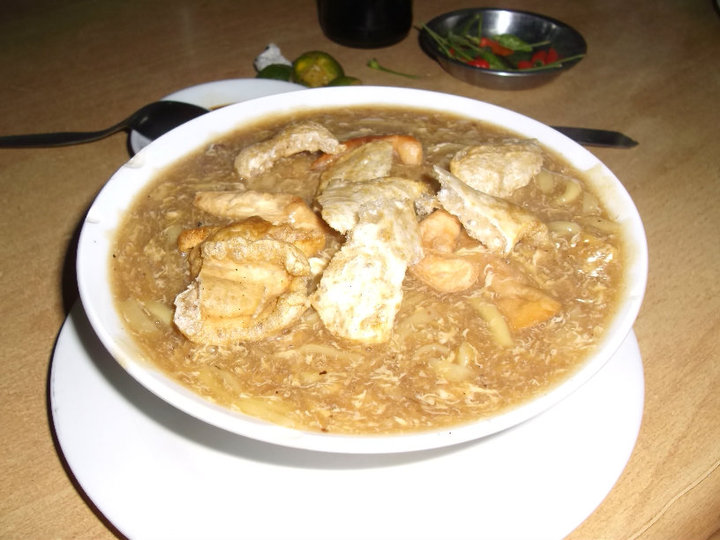
After cleaning up, we walked to find a jeepney that would take us to where we could have dinner. We stopped at Sulyaw sa Grove and I have to tell you, the food there was cheap! It was just so bad that my camera ran out of battery that time that I wasn't able to take any pic of/at the resto. So here's Sulyaw taken from kainlb.blogspot.com:

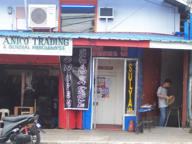
I have to tell you, if you're going to UPLB, you have to drop by Sulyaw to experience good food without shelling out a lot of moolah. There's a catch, though. You have to bring your plates, etc to the counter at the far end of the restaurant after you eat. But they won't make you wash those naman. So okay lang.

After eating, the three sirs went off for a drink, while we head to Alabang. The rest of the team were from Quiapo so they still had to take another bus ride from Alabang, while I took a jeepney to go home.

I must say MakTrav is one tiring dayhike. My muscles ached again as if it was my first climb. But there's no regret whatsoever. MakTrav was one heck of an experience.

Here's a compilation of the pics and videos of my Mt. Makiling Traverse with the MLQU Stallions Outdoor Club:

Sunday, November 14, 2010

Mt. Maculot (Grotto-Summit-Rockies)

Mt. Maculot is a favorite destination for new mountaineers. The Rockies, being the most popular point of Mt. Maculot attracts newbie climbers because of its friendly trail and friendlier height (706+ MASL).

The summit, though, is a little bit higher (830 MASL) and the difficulty depends on which trail you use. As for adventure-seeking newbies, my friend Danilo and I opted for the more difficult traverse by way of the grotto trail.

We set off last September 20, a Monday, leaving the house at 1 am for our much anticipated first climb together. This was his first mountain, and my second - the first being Mt. Romelo in Siniloan, Laguna.

We arrived at Cuenca a little past 5 am, starving. Good thing there was one open carinderia offering stuff to warm our tummies. So we had a big serving of Lomi for only 35 pesos each.

Asking the store-owner for directions to the local church, we reached St. Isidore Parish just when that morning's mass was about to end. Quite admirably, they hold daily masses there at 5:30 every morning. Only a few church-goers were present, though. But it's still admirable enough that they wake up that early just to attend mass.

We passed by this toll gate slash registration area for those wanting to climb.

When we asked for a guide, the Barangay Tanod told us to go to the store beside the Barangay Hall (of Barangay Tico) a lil farther from the gate. The store also serves as an alternate registration area for climbers.

The guide that the store-owner gave us, though, only wanted to bring us to The Rockies. He discouraged us to do a traverse saying that no one does that anymore and there's no more trail from the summit to The Rockies. Little did he know that we knew someone who did a traverse just a month earlier. After sensing that the guide wouldn’t really be convinced to go with us in a traverse, Danilo called his friend (who recently had a traverse). The friend told us to just hire a tricycle to bring us to the grotto jump-off, which we eventually learned was called Barangay Pinagkaisahan.

The locals at Barangay Pinagkaisahan were much friendlier, we didn’t even have to ask for guides. Sensing what we needed, they pointed us to the house where a kid named Denver lived. The kid was ever so ready to be our guide. He wouldn’t even tell us his fee, leaving it up to how much we wanted to give him.

At exactly 7:11 AM, we started walking towards the grotto trail.

The trail has concrete steps. I could just imagine how full these steps could get during the Lent.

But on most parts, the steps were almost made invisible by towering cogon. And it was so bad that I didn’t bring any arm band or leggings to protect my arms and legs.

The stations of the cross were empty but our guide said the locals put religious icons on those stations during Holy Week when lots of pilgrims hike up to the grotto as a form of physical sacrifice. Danilo and I were kinda fast, stopping only to take pics once in a while. At 8 AM, we were already at the grotto.

We took that moment to take more pics, and moreover, to rest. The grotto offers a good view of Cuenca, it was so hot, though, despite the fact that it’s not even mid-morning yet.

We decided to move on, after 25 minutes of rest, to our next destination – the summit.

The trail to the summit was steep enough that I refrain from looking back. I don’t have bathmophobia, it’s just that I knew I’d feel weak in the knees if I looked back down and it’s still a long climb.

Three times, the trail had to be aided by ropes because it was really steep. Good thing I packed light and left the heavy dome tent at home.

We reached the summit at exactly 9:57 AM. The summit, though, didn’t offer any view because it was surrounded with bushes.

This was me with Denver, our 13-year-old guide.

Moving on, we reached the nearby campsite where we had our lunch. It provided us with much needed “refill” and an hour of rest, plus a change of shirt.

At exactly 11:00 AM, we started walking towards The Rockies. The trail leading down was so forested we had to duck and go over tree branches.

But the sights were so cool I had never seen anything like these.

The heart:

Around 45 minutes later, we were rewarded with our first sight of The Rockies. It’s that part covered with clouds to the right of the pic.

Then we had to pass by the cogon trail and the grass was again taller than us. The trail was actually almost not there anymore. So that’s what the first guide we talked to at Brgy. Tico was saying. But our little guide seemed to really know where he’s going cuz no matter how thick the cogon was, we didn’t get lost.

At 12:00 noon, we were already at The Rockies camp site. Imagine the heat! And it was quite a dismay that trash (even though collected in one place) were just left there by previous campers as if a garbage truck would come passing by and get them.

Then we headed to see The Rockies. It was the middle of the day; scorching hot, the 1 liter I brought with me was almost gone. Good thing Danilo brought 2 liters and was kind enough to share.

We were having second thoughts on whether to climb the rock formation or not. It seemed so steep from afar and there seemed to be no trail. But since we were already there, I decided to give it a try. We just agreed that we shouldn’t force it if we felt like its beyond our capabilities. After all, there’re only the two of us and the kid guide. We couldn’t really risk it if it proved to be a very technical assault.

But then we were surprised to find out it was very easy. Steep it might be, but it’s a very friendly ascent. But being above The Rockies in the middle of a very sunny day was no fun. At one point, we started hearing something popping inside Danilo’s sack. He opened it and found out it was his mineral water bottle getting deformed due to extreme heat. So before we suffer from heat stroke, we decided to take quick pics and head back.

Now that’s supposed to be the Taal Volcano behind me. LoL! Really hard to take pics in the middle of a sunny day especially with point-and-shoot cameras.

Pics turn out to be either so bright or so dark.

We left The Rockies at 1:05 PM. Still many hours to kill but there’s nothing much left to do up there, aside from the fact that we almost don’t have water anymore.

One hour and 10 minutes was all it took for us to reach the first stop over – the U.W.A.C. (Unified Wanderers Adventurers Club).

Being a Monday, they don’t have anything to offer but colas and mineral water, not even the “Banana Ice” I have so many times read about on the interwebs. But we were able to wash-up for a fee of 15 pesos per pail of water, and eat the boiled eggs my mother woke up early to cook that day.

There were no one else at the stop-over and since it was still very early to hurry up, we took some time to rest our aching muscles. But since I’m a person who gets tired of a place (aside from my house) so easily especially when there’s nothing to do, I had to keep going 45 minutes later.

Now, this was the first time we saw this sign since we started the climb in Barangay Pinagkaisahan. Lovely road. I won’t call it quaint, but it’s definitely a very simple town. Sometimes, I can’t help but wish for a life this simple.

Anyway, we reached Cuenca town 3:25 PM where we took a jeepney ride to Lipa. By 4:15 PM, we were already eating as much as our tummies could take at Jollibee Lipa. It was a tiring day after all, and even fast food tasted like heaven.

Bus to Alabang left at 5 PM and we literally slept all throughout the 2-hour ride. I was home by 8 PM. It was by far the earliest I went home after a day-hike.

HOW TO GET TO MT. MACULOT

* Ride a bus to Lipa (Php77.00 from Alabang)

* Take a Cuenca-bound jeep (Php23.00) and asked to be dropped at the town proper

* Walk or take trike to the Barangay Outpost of Barangay Tico for registration Php10.00

* If you’re going to The Rockies and you need a guide, you can get one at the store near the Barangay Hall (the store also serves as an alternate registration); but if you’re going to the Grotto, go straight to Barangay Pinagkaisahan and go get your guide there.

* If you’re doing a traverse, better get a guide at Barangay Pinagkaisahan. From personal experience, no guide in Barangay Tico wants to do a traverse. Better yet, ask for the kid named Denver at Barangay Pinagkaisahan. The kid is initially shy, but becomes friendly after a while. We gave him Php600 for the traverse.

* Don’t forget to bring extra food for the guide(s).

Twitter Delicious Facebook Digg Stumbleupon Favorites More

 
Powered by Blogger