11/25/2010 10:29:00 AM
 noel
noel

I've always wanted to go to Anawangin cuz I've always read and heard so many beautiful things about it. So when I learned that K's third training climb with the MLQU Stallions Outdoor Club would be Mt. Pundaquit with a 2-day stay at the Anawangin Cove, I immediately begged him to ask their president if I could guest-climb with them.
It was a short-notice, though. He informed me Wednesday night (Nov 3) that the club allowed me to go with them; assembly was 8 PM Friday (Nov 5). I immediately canceled my Balagbag Falls day trip with a friend that Saturday. But I couldn't cancel Princess' follow-up CBC that Friday.
And I crammed. The itinerary included a boat ride from Anawangin to Capones Island to Pundaquit on the way home, and I don't know how to swim!
So after bringing Princess to the vet Friday morning (and learning that her RBC's kinda high which might result into a stroke [God forbid]), I went to the mall to buy stuff including a whistle, soccer socks for compression (I over estimated the mountain, it is only 400 something MASL), a box of Ziploc, a headlamp, and a float vest. I know, I'm so paranoid.

LoL!
It actually fit in my 40L Sandugo backpack with the earth pad, Lock & Locks, and these:

So K, Gerald, and I rode the PNR, which was my first PNR ride. It was SRO, but good enough.

Anyway, only a few of them were at the MLQU grounds when we arrived.

After several trips to 7-11 (I really can't stand waiting and doing nothing), we left MLQU around 10:30 PM for the Victory Liner terminal. All 20 of us had been reserved for the 11:05 PM bus bound for Zambales. It was cool that Victory Liner leaves on time. And it was so cold that I started having a cold halfway through the ride. What's more, most of our jackets were inside our rucksacks which were deposited at the baggage area under the bus. Foolish me, it was my first time to ride an aircon bus since I started traveling and keeping a sweater with me on bus rides had never been something to make a special note about.
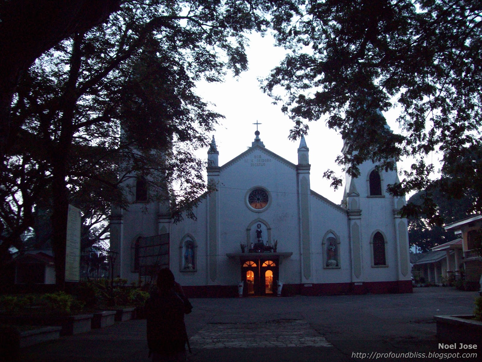
But just the same, we arrived in San Antonio, Zambales in one piece (plus a cold for me). It was 3:00 AM. We then took a tricycle ride to the jump-off where we had an early breakfast, use of the bathroom, and a warm-up.

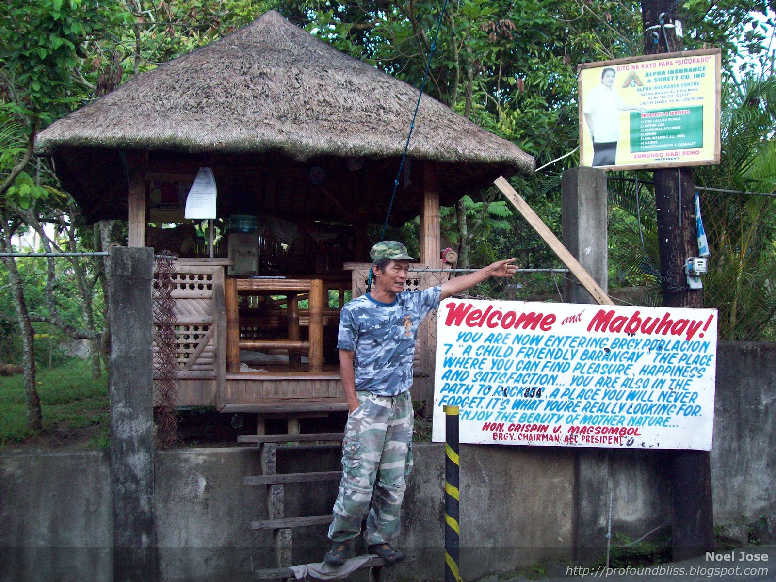
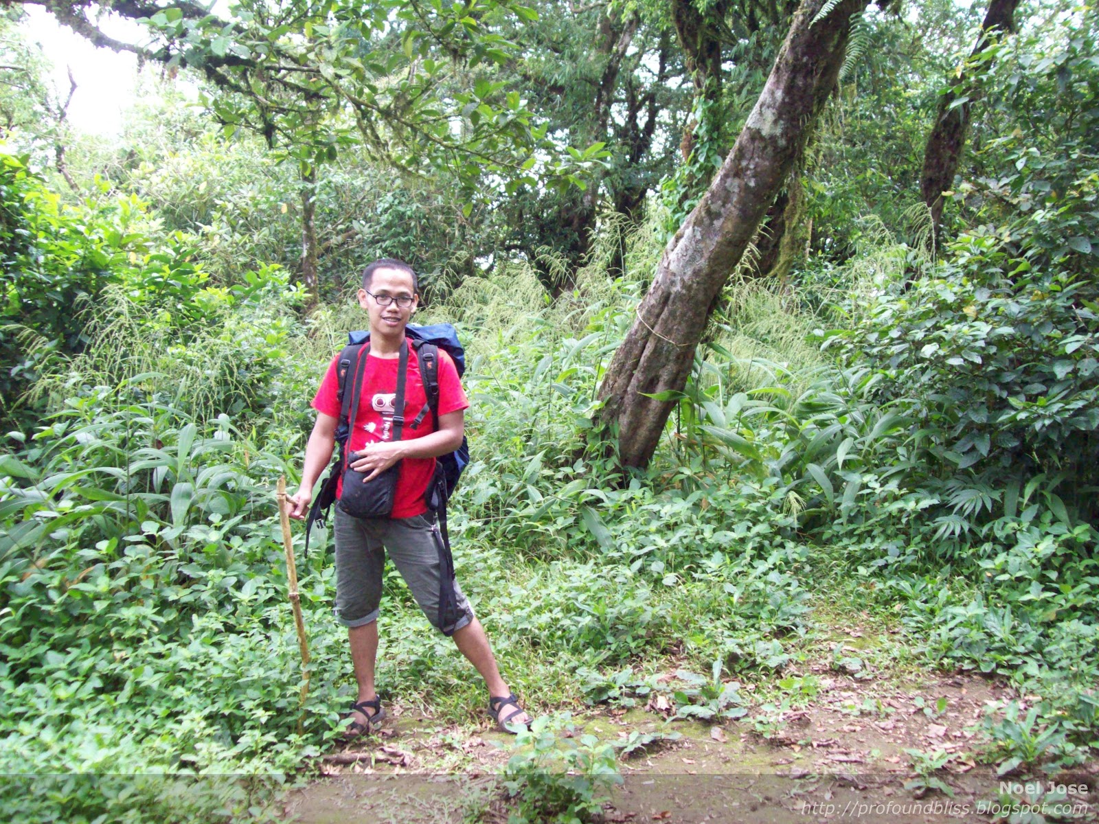
We started the hike at 4:30 AM. It was so dark that those without headlamps were made to walk in between those who had. So nice that I bought one. I actually didn't wanna experience ever again what happened to us in Pico de Loro.

Look! All sweaty in the wee hours of the morning.

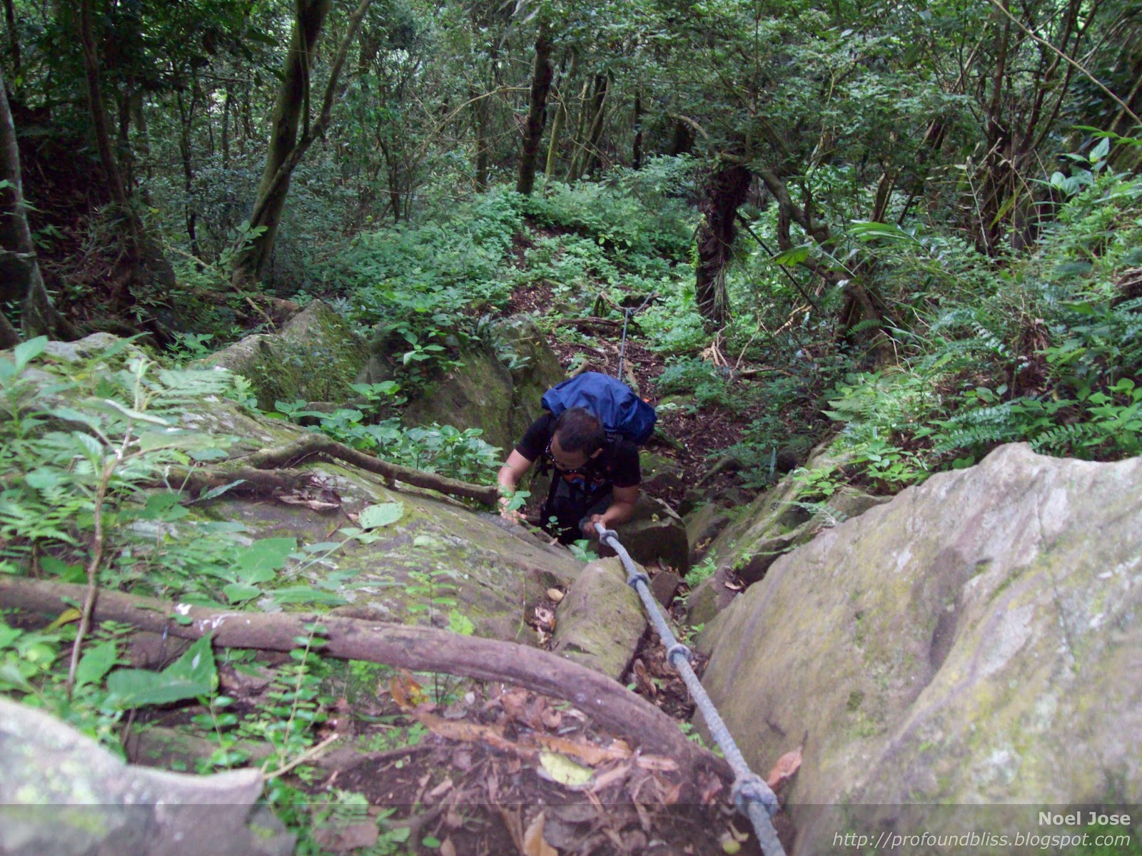
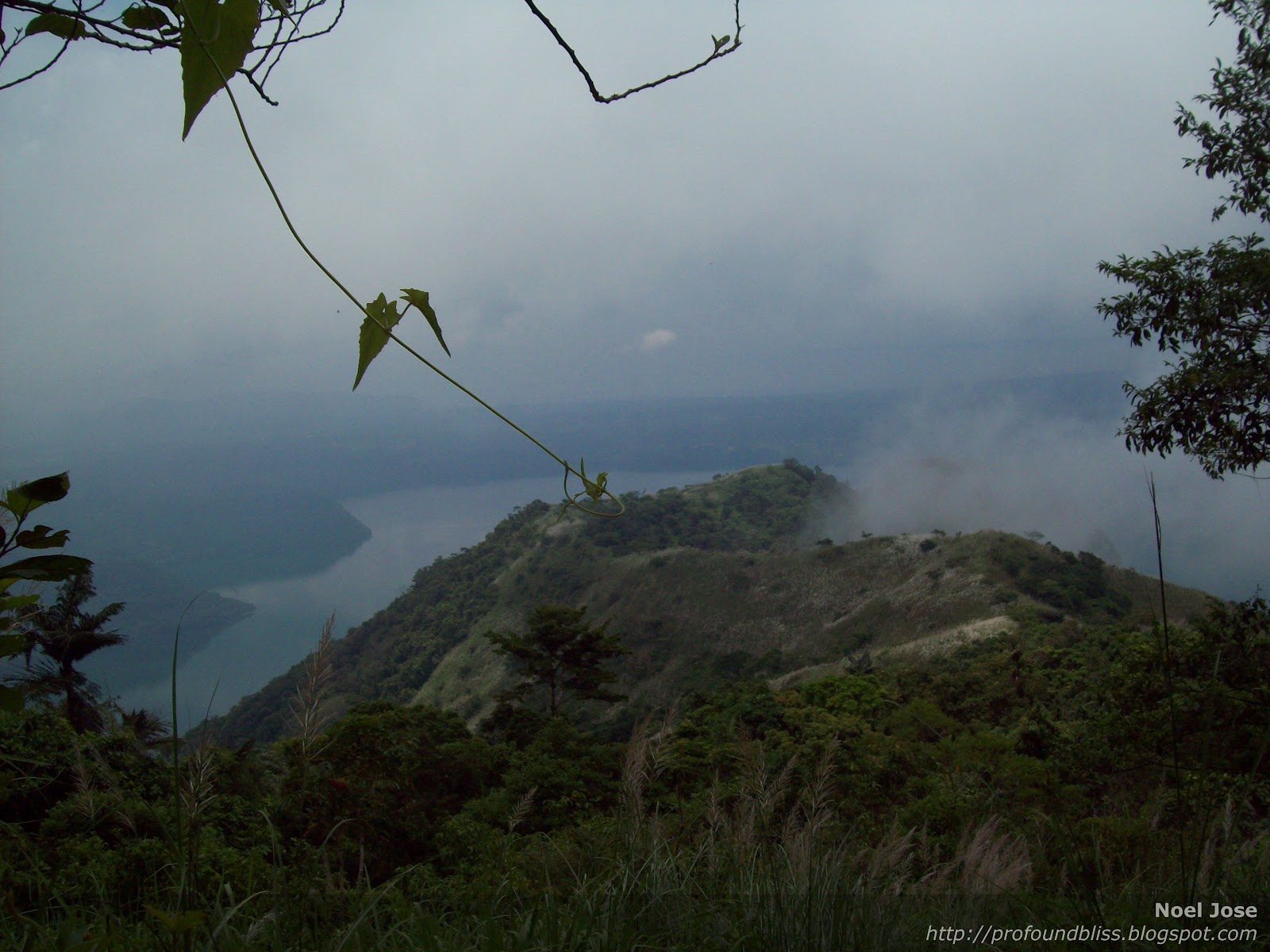
It was a friendly trail, almost flat then moderately steep less than an hour into the Anawangin Saddle which is the midpoint of the traverse. It is also the summit, but to better say that you've been to Mt. Pundaquit's summit, you can trek up a little higher to the right to what seem to be a hill on top of the mountain.

It was 6:15 AM when we reached the saddle. It wasn't dark anymore but the sun was still hidden behind the mountains. The mountain is a grassland, and at that point, I could understand why the Stallions wanted a night climb. We would literally toast under the heat of the sun with no tree to give us shade if we climbed during the day.

We stopped at the saddle, taking a break and regrouping. From the jump-off, I was already part of the tail group, actually positioned at the very end of the tail that I wasn't pressured or anything to keep up with the pace. LoL! But then something happened to the leg of one of the members in the tail group making most of the members stop to wait up for him, therefore the applicants and the guests reached the saddle ahead of the members. The applicants should have been in the middle of the team leader's group and the tail group. But since someone was hurt, I was among the first few to reach the saddle. LoL!

And that's the Anawangin Beach low behind me.
After taking forever, we resumed the trek. Since it was a deliberation climb, the applicants were made to find their way from that point on. The members would leave trail marks along the way, which would test the applicants' skills to read the signs.
So we were divided into three groups again. The members would all take the lead, then the applicants (aside from K and another applicant named Eric) would follow trail after 30 minutes. Then the two guests (I included) with K and Eric (who looked like a high school student, btw), formed the tail group. And we were to leave the saddle 30 minutes after the middle group of applicants.


It was funny, though, that after only a few minutes of walking, we spotted the end of the middle group. So the four of us rested again to let the group ahead of us keep their distance.
It was the most relaxed time of the trek for me. First, it was a descent. As much as others say they hate descents because it hurts their knees or whatever, I love it even more than uphill trekking. Secondly, Eric and K were two of the most behaved applicants and we shared lighthearted talks while resting and walking.
At the foot of the mountain, we again found the other applicants just about to leave after taking a rest. K and Eric started teasing the group on how slow and weak they were. Then K, being the leader of the tail group, decided to take a different trail than the other group was taking. And then we started seeing trail signs. As it turned out, we took the right path to the beach.

After all the rests and stops, we arrived at Mansayon Beach Resort a little before 8:00 AM.

Don't let it fool you, though. Not because there's a so-called resort in the area doesn't mean they have all the amenities you have in mind. They have old-fashioned toilets (no flush), and deep well hand pumps the water of which smelled like kalawang so it's not really potable. They don't have cottages so you really have to bring your own tents if you're staying overnight. I was advised by K to bring my tent so I brought my 4-person dome which I realized was 9 years old already. I wasn't able to take any picture of it at Anawangin but it's the same tent I used at Kwebang Lampas.
When it rained at the camp Saturday night, though, I realized I needed to buy a new one. Water, though minimal and not really noticeable unless you're like me who keeps noticing the weirdest of things, can now seep at the seams.
But before it was night (sorry for the fast-forward), I immediately roamed around after settling. No one wanted to go with me cuz it was stifling hot so I walked around alone.
The cove has such a calming atmosphere that I could just stay there for hours and not get tired of the place. What's actually good about it aside from the natural beauty of the place is that there are minimal tourists around.
Thanks to the person who invented the digicam's timer, I was able to take pics of me even when I was roaming the place alone.


When I spotted the hill to the left of the beach, I knew it was where those amazing pics of Anawangin Cove were taken. I immediately headed to the direction of the hill but stopped and thought twice about crossing that little patch of water going towards the cove.

My reason for hesitating to cross the water? This:

Haha! And the stories that you can't really be too careful when swimming in Anawangin so you have to wear your float vest all the time. Okay, paranoia. But that's me.
I really had to go back to the little store selling overpriced sodas to ask the vendor if it's safe to cross the water on that side of the beach, blah, blah. They said it's safe but that I have to be careful on going up the hill.
On my way to the store, though, I saw K, Gerald, and Troy walking along the beach. I didn't know K followed me on my way back to the hill until I was about to cross the water.
It was waist deep (on my 5'3" height, btw) and the little fishes were ticklish despite the leggings I was wearing under my shorts.
Part 2 of my Mt. Pundaquit - Anawangin Cove Adventure to follow.
It was a short-notice, though. He informed me Wednesday night (Nov 3) that the club allowed me to go with them; assembly was 8 PM Friday (Nov 5). I immediately canceled my Balagbag Falls day trip with a friend that Saturday. But I couldn't cancel Princess' follow-up CBC that Friday.
And I crammed. The itinerary included a boat ride from Anawangin to Capones Island to Pundaquit on the way home, and I don't know how to swim!
So after bringing Princess to the vet Friday morning (and learning that her RBC's kinda high which might result into a stroke [God forbid]), I went to the mall to buy stuff including a whistle, soccer socks for compression (I over estimated the mountain, it is only 400 something MASL), a box of Ziploc, a headlamp, and a float vest. I know, I'm so paranoid.
LoL!
It actually fit in my 40L Sandugo backpack with the earth pad, Lock & Locks, and these:
So K, Gerald, and I rode the PNR, which was my first PNR ride. It was SRO, but good enough.
Anyway, only a few of them were at the MLQU grounds when we arrived.
After several trips to 7-11 (I really can't stand waiting and doing nothing), we left MLQU around 10:30 PM for the Victory Liner terminal. All 20 of us had been reserved for the 11:05 PM bus bound for Zambales. It was cool that Victory Liner leaves on time. And it was so cold that I started having a cold halfway through the ride. What's more, most of our jackets were inside our rucksacks which were deposited at the baggage area under the bus. Foolish me, it was my first time to ride an aircon bus since I started traveling and keeping a sweater with me on bus rides had never been something to make a special note about.
But just the same, we arrived in San Antonio, Zambales in one piece (plus a cold for me). It was 3:00 AM. We then took a tricycle ride to the jump-off where we had an early breakfast, use of the bathroom, and a warm-up.
We started the hike at 4:30 AM. It was so dark that those without headlamps were made to walk in between those who had. So nice that I bought one. I actually didn't wanna experience ever again what happened to us in Pico de Loro.
Look! All sweaty in the wee hours of the morning.
It was a friendly trail, almost flat then moderately steep less than an hour into the Anawangin Saddle which is the midpoint of the traverse. It is also the summit, but to better say that you've been to Mt. Pundaquit's summit, you can trek up a little higher to the right to what seem to be a hill on top of the mountain.
It was 6:15 AM when we reached the saddle. It wasn't dark anymore but the sun was still hidden behind the mountains. The mountain is a grassland, and at that point, I could understand why the Stallions wanted a night climb. We would literally toast under the heat of the sun with no tree to give us shade if we climbed during the day.
We stopped at the saddle, taking a break and regrouping. From the jump-off, I was already part of the tail group, actually positioned at the very end of the tail that I wasn't pressured or anything to keep up with the pace. LoL! But then something happened to the leg of one of the members in the tail group making most of the members stop to wait up for him, therefore the applicants and the guests reached the saddle ahead of the members. The applicants should have been in the middle of the team leader's group and the tail group. But since someone was hurt, I was among the first few to reach the saddle. LoL!
And that's the Anawangin Beach low behind me.
After taking forever, we resumed the trek. Since it was a deliberation climb, the applicants were made to find their way from that point on. The members would leave trail marks along the way, which would test the applicants' skills to read the signs.
So we were divided into three groups again. The members would all take the lead, then the applicants (aside from K and another applicant named Eric) would follow trail after 30 minutes. Then the two guests (I included) with K and Eric (who looked like a high school student, btw), formed the tail group. And we were to leave the saddle 30 minutes after the middle group of applicants.
It was funny, though, that after only a few minutes of walking, we spotted the end of the middle group. So the four of us rested again to let the group ahead of us keep their distance.
It was the most relaxed time of the trek for me. First, it was a descent. As much as others say they hate descents because it hurts their knees or whatever, I love it even more than uphill trekking. Secondly, Eric and K were two of the most behaved applicants and we shared lighthearted talks while resting and walking.
At the foot of the mountain, we again found the other applicants just about to leave after taking a rest. K and Eric started teasing the group on how slow and weak they were. Then K, being the leader of the tail group, decided to take a different trail than the other group was taking. And then we started seeing trail signs. As it turned out, we took the right path to the beach.
After all the rests and stops, we arrived at Mansayon Beach Resort a little before 8:00 AM.
Don't let it fool you, though. Not because there's a so-called resort in the area doesn't mean they have all the amenities you have in mind. They have old-fashioned toilets (no flush), and deep well hand pumps the water of which smelled like kalawang so it's not really potable. They don't have cottages so you really have to bring your own tents if you're staying overnight. I was advised by K to bring my tent so I brought my 4-person dome which I realized was 9 years old already. I wasn't able to take any picture of it at Anawangin but it's the same tent I used at Kwebang Lampas.
When it rained at the camp Saturday night, though, I realized I needed to buy a new one. Water, though minimal and not really noticeable unless you're like me who keeps noticing the weirdest of things, can now seep at the seams.
But before it was night (sorry for the fast-forward), I immediately roamed around after settling. No one wanted to go with me cuz it was stifling hot so I walked around alone.
The cove has such a calming atmosphere that I could just stay there for hours and not get tired of the place. What's actually good about it aside from the natural beauty of the place is that there are minimal tourists around.
Thanks to the person who invented the digicam's timer, I was able to take pics of me even when I was roaming the place alone.
When I spotted the hill to the left of the beach, I knew it was where those amazing pics of Anawangin Cove were taken. I immediately headed to the direction of the hill but stopped and thought twice about crossing that little patch of water going towards the cove.
My reason for hesitating to cross the water? This:
Haha! And the stories that you can't really be too careful when swimming in Anawangin so you have to wear your float vest all the time. Okay, paranoia. But that's me.
I really had to go back to the little store selling overpriced sodas to ask the vendor if it's safe to cross the water on that side of the beach, blah, blah. They said it's safe but that I have to be careful on going up the hill.
On my way to the store, though, I saw K, Gerald, and Troy walking along the beach. I didn't know K followed me on my way back to the hill until I was about to cross the water.
It was waist deep (on my 5'3" height, btw) and the little fishes were ticklish despite the leggings I was wearing under my shorts.
Part 2 of my Mt. Pundaquit - Anawangin Cove Adventure to follow.